After the past week of intense rainfall on frozen ground, our area lakes and rivers are now at or near the 100-year flood stage, according to a news release from The Watershed Foundation.
Understanding how the watershed moves water can provide an insight into the flooding.
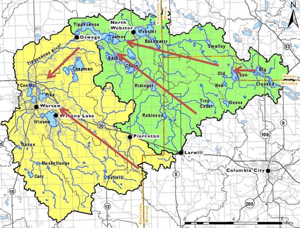
A watershed works like a funnel, moving water downstream and draining to a particular body of water. The Tippecanoe River watershed begins north of Columbia City. Eventually, the water in the green area all passes through the Dam at Oswego then, down the Tippecanoe River to the Warsaw-area (see map).
As of Monday afternoon, the Tippecanoe River at Oswego stood at 8.77 inches, which is the fifth highest level recorded since 1943.
Below is a list of the historic crests recorded by United State Geological Survey:
- 9.40 feet on 05/21/1943
- 9.25 feet on 03/21/1982
- 8.96 feet on 03/15/2009
- 8.89 feet on 03/04/1985
- 8.77 feet on 02/26/2018
Homeowners, renters, businesses and private non-profit organizations that sustained uninsured damage caused by severe storms and flooding starting on or after February 15 are encouraged to report damage online at: https://tinyurl.com/GovDamage.


